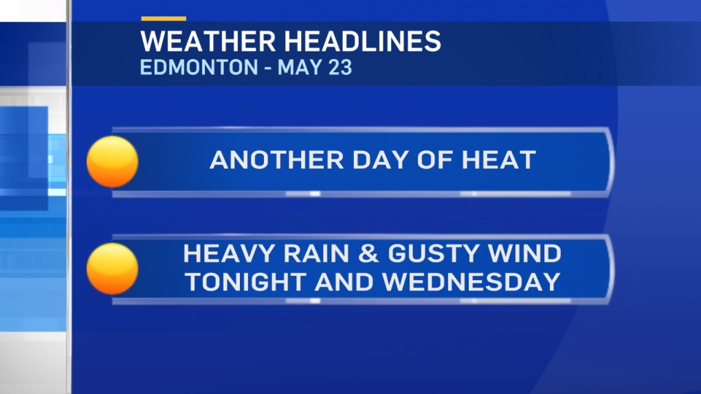
The long weekend heat continues for another day.
Edmonton had highs of 23 Sat / 24 Sun / 26 Mon and we should get to 28 today.
HOWEVER...there's a full day of heavy rain and wind on tap for Wednesday.
Periods of rain and possible thunderstorms hit parts of W and NW Alberta tonight.
In higher elevations of the mountain and foothills, the rain may change over to heavy snow late tonight.
Rain starts overnight or early Wednesday in Central and Eastern Alberta.
HOW MUCH:
potential rain totals range from 10-40mm for most areas.
However, areas that get thunderstorms could see rainfall totals pushed into the 70-80mm range.
Rain should taper off midday Wednesday in the NW.
In areas from Athabasca south through Edmonton and into the Red Deer area, the rain should end late Wednesday.
Eastern Alberta might see rain continue into Thursday morning.
Strongest Wind Gusts:
- tonight and Wednesday in the W & NW.
- Wednesday in Edmonton/Red Deer areas.
- Wednesday afternoon and Thursday in E & NE.
Here's the Edmonton forecast:
Today - Mix of sun & cloud.
High: 28
Tonight - Increasing cloud. 30% chance of showers or thunderstorms overnight.
Evening: 19
Wednesday - Periods of rain. 20-40mm possible.
Wind: N 30 gusting to 50km/h in the morning. Gusts to 80km/h in the afternoon.
Morning Low: 11
Afternoon High: 13
Thursday - Clearing & windy. N 30 gusting to 50 (especially in the morning)
Morning Low: 8
Afternoon High: 17
Friday - Partly cloudy.
Morning Low: 7
Afternoon High: 20
Saturday - Mainly sunny.
Morning Low: 9
Afternoon High: 22
Sunday - Partly cloudy.
Morning Low: 9
Afternoon High: 22
Advertisement
HOT TODAY...WET & WINDY WEDNESDAY - May 23
CTV Edmonton
Published Tuesday, May 23, 2017 9:04AM MDT
Published Tuesday, May 23, 2017 9:04AM MDT
