One cool day...and then we start to warm back up.
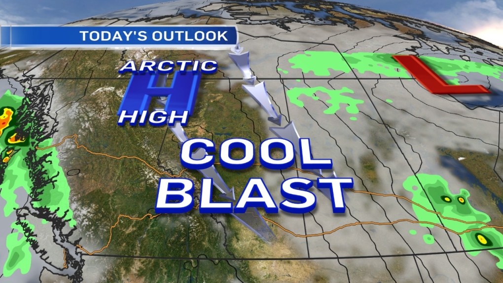
An arctic high is dropping in from the NW and that'll keep temperatures in single digits all day.
We'll get some sun, but it'll be "brisk" all day.
Most of the Capital Region is already getting some clearing this morning.
There were a few small pockets of light & wet flurries, mainly E & NE of Edmonton early this morning.
The snow is sticking to the ground in ditches in some areas, but won't last past Noon.
The arctic high won't last long either. It gets shoved off to the SE by Friday.
A strong area of low pressure off the west coast will push some warmer air back into Alberta Fri/Sat/Sun.
There's a chance of showers Friday in W & NW Alberta.
Central Alberta could get some showers Friday night.
No snow risk.
It'll be warm enough in the mid levels of the atmosphere for that precipitation to fall as rain.
Partly cloudy for Saturday afternoon & Sunday with temperatures in the mid-teens.
Not a bad first weekend of October.
Here's the Edmonton forecast:
Today - Clearing this morning. Sunny with a few clouds this afternoon.
Wind: WNW 30 with 40-50km/h gusts this morning. WNW 20-30 this afternoon.
High: 8
Tonight - A few clouds. Wind easing this evening.
Low: -2
Friday - Increasing cloud. 30% chance of a few showers in the evening.
High: 12
Saturday - 30% chance of a shower early in the morning.
Partly cloudy in the afternoon.
Morning Low: 6
Afternoon High: 17
Sunday - Partly cloudy.
Morning Low: 7
Afternoon High: 16
Monday - Mix of sun & cloud.
Morning Low: 6
Afternoon High: 17
Tuesday - Mostly cloudy.
Morning Low: 5
Afternoon High: 12
Advertisement
SHORT-LIVED COOL SNAP - October 2, 2014
CTV Edmonton
Published Thursday, October 2, 2014 7:08AM MDT
Published Thursday, October 2, 2014 7:08AM MDT
