Edmonton weather for Nov. 15: Snowstorm set to slam in

EDMONTON -
Between 10 and 20 cm of snow, gusty wind and a big drop in temperature.
Our snow-free, warmer-than-average November is coming to a screeching halt.
After getting our first snowfall on Sunday in Edmonton, we're in for a LOT more by midday Tuesday.
AND...temperatures are set to be a lot cooler than we've had for a while.
It may not have amounted to much, but we'll count Nov. 14 as the first snowfall this season.
So...as the brilliant @yegwxnerdery points out, only 1988, 1976, 1891 and 1886 had "first snowfalls" this late or later.
Edmonton will be close to the snow/freezing line. BUT...it appears that line will setup up to the south of the city.
That's why we're looking at "special weather statements" for areas south of Highway 16.
From the Drayton Valley area east to the Saskatchewan border, freezing rain is likely, followed by a couple centimetres of snow.
(Areas around Red Deer probably only get 1 to 5 cm of snow.)
Meanwhile, Edmonton and areas north of Highway 16 (all the way to Grande Prairie and Slave Lake) are under a snowfall warning.
Between 10 and 25 cm of snow is expected through the areas within that warning zone starting in the west and moving east through the day.
In the mountain parks AND in the Cold Lake/Bonnyville region, a winter storm warning is in effect.
Thirty to 60 cm of snow is likely in the mountains. Twenty to 30 cm of snow is likely in parts of northeastern and east-central Alberta.
(I think we'll likely get a winter storm warning or snowfall warning for the Lloydminster/Vermilion region later today.)
The heaviest snow for Edmonton should be done by early Tuesday morning, but it may not completely stop snowing until Tuesday afternoon.
Wind is going to be an aggravating factor later today and through the first half of Tuesday.
Gusts to around 30 to 40 km/h are likely later today and we're expecting gusts in the 60 to 70 km/h range overnight and through to early Tuesday afternoon.
Wind is expected to back off in the evening Tuesday.
Temperatures will hover around zero for most of today and then we're looking at daytime highs in the -1 to -5 range for the rest of the week.
Here's the forecast for Edmonton:
Today - Cloudy with periods of snow starting midday, turning to heavy snow this afternoon.
Wind: East 20 gusting to 40 km/h this afternoon.
Temperature steady near 0
Tonight - 10-20 cm of snow. Wind becoming NW 40 gusting to 70 km/h overnight.
9pm: -1
Tuesday - Snow tapering off in the morning and ending in the afteroon.
Wind gusts in the 60-70 km/h range through the morning. Wind easing late in the afternoon.
Temperature falling through the day.
7am: -3
3pm: -5
7pm: -7
Wednesday - Mainly sunny.
Morning Low: -12
Afternoon High: -4
Thursday - Partly cloudy.
Morning Low: -10
Afternoon High: -3
Friday - Mix of sun & cloud.
Morning Low: -9
Afternoon High: -2
Saturday - Mostly cloudy. 30% chance of flurries.
Morning Low: -10
Afternoon High: -6


CTVNews.ca Top Stories

NEW
NEW Keeping these exotic pets is 'cruel' and 'dangerous,' Canadian animal advocates say
Canadian pet owners are finding companionship beyond dogs and cats. Tigers, alligators, scorpions and tarantulas are among some of the exotic pets they are keeping in private homes, which pose risks to public safety and animal welfare, advocates say.
NEW
NEW Life got in the way of one woman's reunion with her father, but a DNA test gained her a family
Anne Marie Cavner was the closest she'd ever been to meeting her biological father, but then life dealt her a blow. From an unexpected loss to a host of new relationships, a DNA test changed her life, and she doesn't regret a thing.
Doctors ask Liberal government to reconsider capital gains tax change
The Canadian Medical Association is asking the federal government to reconsider its proposed changes to capital gains taxation, arguing it will affect doctors' retirement savings.
How quietly promised law changes in the 2024 federal budget could impact your day-to-day life
The 2024 federal budget released last week includes numerous big spending promises that have garnered headlines. But, tucked into the 416-page document are also series of smaller items, such as promising to amend the law regarding infant formula and to force banks to label government rebates, that you may have missed.
Quebec farmers have been protesting since December. Is anyone listening?
Upset about high interest rates, growing paperwork and heavy regulatory burdens, protesting farmers have become a familiar sight across Quebec since December.
'Catch-and-kill' strategy to be a focus as testimony resumes in Trump hush money case
A veteran tabloid publisher was expected to return to the witness stand Tuesday in Donald Trump's historic hush money trial.
Quebec Health Department reports 28 cases of eye damage linked to solar eclipse
Quebec's Health Department says it has received 28 reports of eye damage related to the April 8 total solar eclipse that passed over southern parts of the province.
Psychologist becomes first person in Peru to die by euthanasia after fighting in court for years
A Peruvian psychologist who suffered from an incurable disease that weakened her muscles and had her confined to her bed for several years, died by euthanasia, her lawyer said Monday, becoming the first person in the country to obtain the right to die with medical assistance.
Diver pinned under water by an alligator figured he had choice. Lose his arm or lose his life
An alligator attacked a diver on April 15 as he surfaced from his dive, nearly out of air. His tank emptied with the gator's jaws crushing the arm he put up in defence.
Shopping Trends
The Shopping Trends team is independent of the journalists at CTV News. We may earn a commission when you use our links to shop. Read about us.


Calgary
-

Residential school survivor leads class-action lawsuit against Catholic Church, priest
Monday, a judge ruled a proposed class-action lawsuit can go forward despite efforts from lawyers representing the archdiocese of Edmonton and a religious order to have it struck down.
-
Suspect in deadly Calgary shooting has 'Edmonton ties': police
Calgary police have released a photo of a man wanted after a deadly shooting in the community of Shawnessy last month.
-
Calgarians to weigh in on rezoning during largest hearing in city history
The largest public hearing in the city’s history is set to get underway Monday morning.
Lethbridge
-
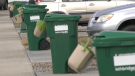
Lethbridge green cart program a success one year in, city says
The City of Lethbridge is calling the first year of its curbside organics waste collection program a success.
-
Coaldale RCMP seek information on hit-and-run
Coaldale RCMP are looking for the public's help to locate a suspect in a hit-and-run in a McDonald's parking lot earlier this month.
-
Deal to protect ranch from development means family can keep raising cattle there
An agreement to protect a sprawling ranch in southern Alberta from development is the largest of its kind in the country, the Nature Conservancy of Canada says, and will allow the family that owns it to continue raising cattle there.
Saskatoon
-

Sask. broker says halal mortgages are not a new concept in Canada
A Saskatoon mortgage broker says the federal government’s move to help Muslim Canadians get into the housing market by promoting halal mortgages is not such a radical idea — it’s helping families buy their first home without breaking their faith.
-
Sask. driver caught using vice grips in place of steering wheel
A driver caught using vice grips in place of a steering wheel was ticketed Wednesday after being stopped by police on a rural road.
-
Saskatchewan Rush look to 'better mentality next year' as they miss playoffs again
The Saskatchewan Rush are absent from the National Lacrosse League playoffs for a third straight season, a difficult end to an postseason push born out of a rocky start.
Regina
-

One year after fatal collision, Regina council has final say on lower speed limit in Cathedral
Regina city councillors are set to consider lowering the speed limit in the Cathedral neighbourhood to 30 kilometres per hour on Wednesday.
-
Sask. NDP leader combats claims of carbon tax support following Ottawa visit
Members of the Sask. Party claim a recent trip by the leader of the opposition reveals her party's secret support for the federal carbon tax.
-
Sask. NDP call for education minister's firing, premier reconfirms confidence
The Saskatchewan NDP are calling for the resignation or firing of Education Minister Jeremy Cockrill, saying he lied about apologizing for comments he made to a mother whose daughter died.
Vancouver
-

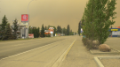
More than firefighters: B.C. chief urges home preparation for wildfire season
As the wildfire season ramps up and a pair of evacuation alerts are now in place, one of British Columbia’s top fire officials is making a personal appeal to the public to take some simple steps that could safeguard their homes.
-
Mystery surrounds giant custom Canucks jerseys worn by Lions Gate Bridge statues
The giant stone statues guarding the Lions Gate Bridge have been dressed in custom Vancouver Canucks jerseys as the NHL playoffs get underway.
-
Calls grow louder for changes to decriminalization in B.C.
Backlash to decriminalization dominated question period Monday in the B.C. legislature, with the Official Opposition BC United and BC Conservatives calling for the province to end the three-year pilot project.
Vancouver Island
-
Police release details about suspect vehicle after fatal B.C. hit-and-run crash
Mounties searching for a driver who struck and killed a woman on Vancouver Island last week released new details about the suspect vehicle Monday.
-
Search for missing kayakers off Vancouver Island expands into U.S.
Authorities on both sides of the Canada-U.S. border resumed search efforts Monday to find two men who went missing while kayaking off Vancouver Island over the weekend.
-
'Historic' law recognizing Haida Aboriginal title introduced in B.C. legislature
The B.C. government says legislation formally recognizing the Haida Nation's Aboriginal title over Haida Gwaii was introduced in the legislature Monday.
Toronto
-
Less than half of Canadians say they will buy an electric vehicle as their next car: survey
A recent survey shows not all Canadians are ready to make the switch to an electric vehicle as they have concerns about charging stations, cold weather and battery life.
-
Toronto police to release updated list of most wanted fugitives in Canada
Toronto police and law enforcement partners will be releasing the BOLO program’s updated list of the top 25 most wanted fugitives in Canada at a news conference on Tuesday morning.
-
Matthews scores winner in the third, Maple Leafs down Bruins 3-2 to even series 1-1
Auston Matthews scored the winner in the third period and added two assists as the Toronto Maple Leafs topped the Boston Bruins 3-2 on Monday to even their first-round playoff series 1-1.
Montreal
-

4 vehicles set ablaze in Montreal garage parking lot
Montreal police are investigating after four vehicles were set on fire Monday night.
-
Quebec farmers have been protesting since December. Is anyone listening?
Upset about high interest rates, growing paperwork and heavy regulatory burdens, protesting farmers have become a familiar sight across Quebec since December.
-
Quebec Health Department reports 28 cases of eye damage linked to solar eclipse
Quebec's Health Department says it has received 28 reports of eye damage related to the April 8 total solar eclipse that passed over southern parts of the province.
Atlantic
-

Youth dead after incident near Halifax Shopping Centre: police
A male youth is dead after an incident near the Halifax Shopping Centre on Monday.
-
Woman airlifted to hospital after N.S. car crash
Three people are in hospital with serious injuries after a two-vehicle crash in New Germany, N.S., on Sunday.
-
Posters promoting theft from Loblaws circulate online
Pictures of a poster encouraging people to steal from Loblaw Companies Limited next month on a specific date have been circulating online.
Winnipeg
-
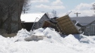
'Never seen this before': Homes in Manitoba community damaged by ice wall
Homeowners in a Manitoba community are cleaning up after being impacted by a natural phenomenon last week.
-
'It's bittersweet': Popular St. Boniface restaurant set to close its doors
Marion Street Eatery is set to close its doors for good after over a decade serving up steaming plates of eggs benedict, grilled cheese and brisket hash.
-
Manitoba could soon end ban of growing recreational cannabis at home
People in Manitoba could soon be able to grow recreational cannabis in their homes.
Ottawa
-
 NEW THIS MORNING
NEW THIS MORNING Pembroke, Ont. hospital anticipating doctor shortages this spring and summer
The Pembroke Regional Hospital says it is expecting longer wait times this spring and summer because of anticipated physician shortages.
-
3 children injured after truck and school bus collide in Russell, Ont.
Three children and a driver were taken to hospital after a school bus and a truck collided on Route 400 in Russell, Ont.
-
Cool temperatures return to Ottawa, with a chance of flurries on Wednesday
A cold few days are in the forecast for the city of Ottawa, before spring-like temperatures return in time for the weekend.
Northern Ontario
-

Man responsible for northern Ont. crash that killed woman days before her wedding fined $5K
It was a sad scene at Tom Davies Square in Sudbury on Monday morning, where a man was being sentenced for a crash that killed a North Bay woman who was driving to her wedding shower.
-
Inspection blitz takes 130 CMVs off the road, northern Ont. police say
Hundreds of drivers were charged in a recent three-day commercial motor vehicle blitz conducted by the Ontario Provincial Police and Ministry of Transportation.
-
WATCH
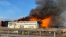
WATCH 'I couldn't believe it': Freight train on fire rolls through downtown London, Ont.
The investigation into how a train moving through the City of London caught fire has been turned over to the CP Rail police. Just before 11 p.m. on Sunday, London fire received multiple 911 calls about an eastbound train on fire, crossing over Oxford Street.
Barrie
-
The man who gave us 'Carefree Highway' has a street of his own
Orillia council authorized a bylaw to rename Centennial Drive Lightfoot Drive at its meeting on Monday.
-
Midland police net knives in routine stop
A routine patrol in Midland turned up an illegal driver and several prohibited knives.
-
Wrong-way driver on highway 11 causes collision with transport truck
Huntsville OPP charged a driver for going the wrong way on Highway 11 and colliding with a transport vehicle.
Kitchener
-

Man knows who has stolen laptop but can't get it back
A Kitchener man who forgot his laptop on a bus in January says he’s now being asked to pay $750 to get it back from whoever has the device.
-
Suspect in Brantford double shooting knocked on stranger’s door to turn himself in
Brantford police say one person remains in critical condition after a shooting in Brantford Sunday night.
-
Flair flight cancellation leaves Guelph traveller stranded, uninformed
Andrew Mackay from Guelph says he was left stranded in Florida last year after his flight with Flair Airlines was cancelled without his knowledge.
London
-

Car fire on Highway 401 sends one person to hospital
The Dutton/Dunwich Fire Department responded to the scene near mile marker 142 between Currie Road and Iona Road, after the vehicle caught fire.
-
Byron’s colony of rare bank swallows facing new threat
Council is be urged to ensure that a plan to redevelop the Byron Gravel Pit also maintains a summer home for its long-time residents — a colony of bank swallows.
-
Missing Clinton man with Down syndrome found by 'Project Lifesaver'
Brian Gray-Hicks likes to be active, and goes for daily walks near his home in Clinton.
Windsor
-

Ont. man, 81, meets his 57-year-old son for the first time after Swedish man's decades-long search
As a young man, Jim Oran's life took unexpected turns, ultimately leading him to Sweden, where he encountered a woman who would later give birth to a child he never knew existed.
-
Federal offender arrested in London, taken back to Windsor
A federal offender known to frequent southwestern Ontario has been arrested.
-
Amherstburg council votes to explore public boat launch at Ranta Park
The town of Amherstburg may one day soon have a public boat launch at the K. Walter Ranta Memorial Park after agreeing to move forward with a plan, despite the multi-million dollar price-tag.


