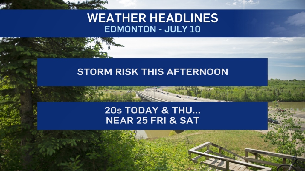
It'll be another active day for storms in central and east-central Alberta. Severe storms are possible over areas to the south and east of Edmonton with large hail and damaging gusts as the main threats.
The Prairie and Arctic Storm Prediction Centre is also discussing the potential for tornadic storms (primarily in east-central Alberta).
Edmonton is on the northern edge of the risk zone. So...most (possibly all) of the worst weather will PROBABLY miss the city.
However, there's still a good chance of some thunderstorms and we can't yet rule out the risk of a severe storm.
Stay tuned to severe weather advisories through the day with the CTV Edmonton weather app.
Temperatures should get to 20 today and Thursday. But, we haven't hit 25 in Edmonton since June 17th.
That's 22 days without hitting 25 degrees.
As @yegwxnerdery points out on twitter - that 22 day stretch is the longest since we went 21 days in 2009.
The last time we had a longer cool spell (in summer) was 1997 - 32 days.
We'll probably end the streak Friday or Saturday.
Here's the forecast for Edmonton:
- Today - Cloudy with a few sunny breaks. 60% chance of showers or thunderstorms this afternoon.
- Risk of severe storms in the area.
- High: 21
- Evening - Mostly cloudy. 60% chance of showers or thunderstorms this evening.
- Risk of severe storms in the area.
- 9pm: 16
- Thursday - Mix of sun & cloud. 30% chance of an afternoon shower.
- Morning Low: 13
- Afternoon High: 20
- Friday - Mainly sunny.
- Morning Low: 13
- Afternoon High: 24
- Saturday - Partly cloudy.
- Morning Low: 13
- Afternoon High: 25
- Sunday - Partly cloudy. 40% chance of a late-day shower or thunderstorm.
- Morning Low: 13
- Afternoon High: 24
- Monday - 30% chance of showers in the morning. Then...Mostly cloudy.
- Morning Low: 14
- Afternoon High: 20
