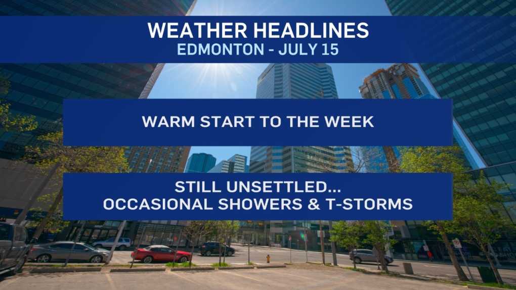
Warmer temperatures are sticking around in the Edmonton region and much of north-central Alberta.
Daytime highs climbed into the mid 20s through the weekend and we're in for more low to mid 20 highs today, Tuesday and Wednesday.
Thu/Fri (and possibly Sat) will be cooler with highs in the 15-20 range and a decent chance of some rain Fri/Sat.
Sunshine this morning will give way to some afternoon clouds. Thunderstorms will fire up through the foothills.
A second area of showers/thunderstorms is expected to develop from the Peace Country SE towards Edmonton.
The metro region has a chance of seeing a scattered shower or thunderstorm this afteroon. Then, another system pushes through and gives the Edmonton area a risk of a shower or thunderstorm late this evening.
Widely-scattered showers and thunderstorms will once again develop in central and north-central Alberta Tuesday afternoon. It has warmed up. But, the unsettled pattern remains.
Here's the forecast for Edmonton:
- Today - Sunny this morning. Partly cloudy this afternoon.
- 30% chance of an afternoon shower or thunderstorm.
- High: 24
- Evening - 40% chance of a shower or thunderstorm this evening or overnight.
- 9pm: 18
- Tuesday - Mix of sun & cloud. 30% chance of a late-day shower.
- Morning Low: 13
- Afternoon High: 23
- Wednesday - Mix of sun & cloud. 30% chance of a late-day shower or thunderstorm.
- Morning Low: 14
- Afternoon High: 24
- Thursday - Mix of sun & cloud.
- Morning Low: 11
- Afternoon High: 19
- Friday - Mostly cloudy. 60% chance of showers.
- Morning Low: 11
- Afternoon High: 18
- Saturday - Mostly cloudy. 60% chance of showers.
- Morning Low: 13
- Afternoon High: 19
