A rainy night has turned to a wet morning across much of the Edmonton region.
Radar and backyard weather station data indicates 2-10mm of rain across most of the area.
Just south of Edmonton, EIA received closer to 15mm (as of 6am) and there appear to be some areas between Beaumont and Wetaskiwin that had 20-40mm overnight (based on radar).
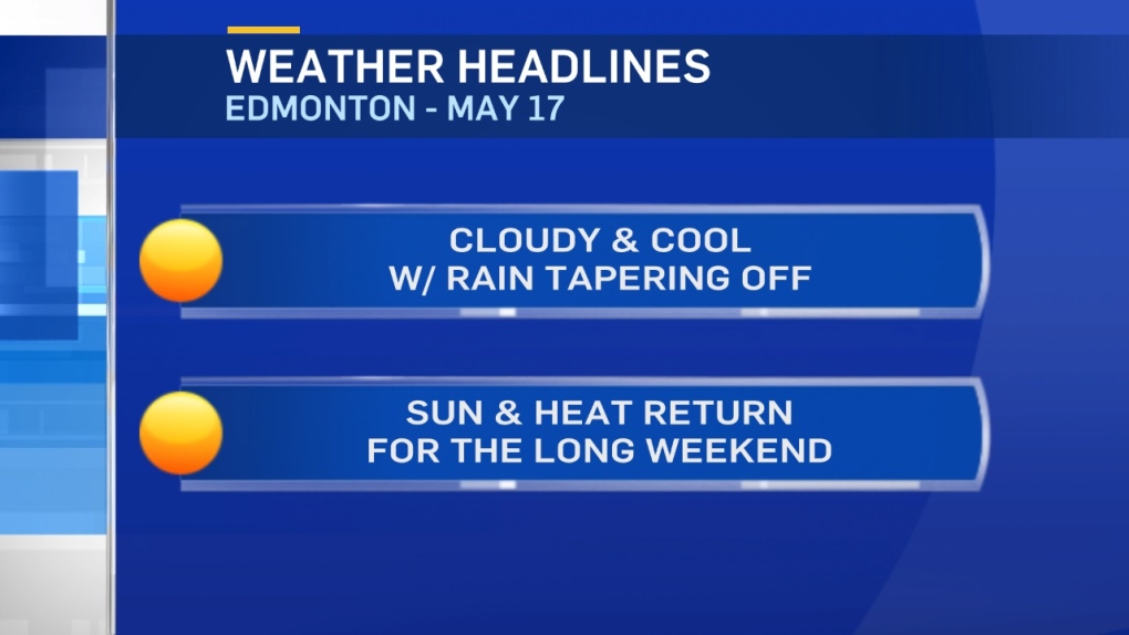
The rain is expected to taper off midday and the Edmonton region will stay cloudy with just a chance of a scattered shower this afternoon.
Areas from Red Deer south through Calgary and west to the mountains continue to get some rain right into this evening.
Temperatures will be stuck in the mid teens for a high in Edmonton today.
That's not worse than about average. But, it's a LOT cooler than the past few days.
And...it's a lot cooler than what's coming.
Sunshine dominates for Friday and the long weekend with highs in the low 20s Fri/Sat.
Mid to upper 20 daytime highs are expected Sun/Mon/Tue.
That heat looks like it may stick around through all of next week as well.
Here's the Edmonton forecast:
Today - Cloudy with showers this morning.
Mostly cloudy and a 30% chance of a shower this afternoon.
High: 16
Evening - Clearing overnight.
9pm: 13
Friday - Mainly sunny.
Morning Low: 5
Afternoon High: 20
Saturday - Mainly sunny.
Morning Low: 8
Afternoon High: 23
Sunday - Mainly sunny.
Morning Low: 10
Afternoon High: 25
Monday - Mainly sunny.
Morning Low: 10
Afternoon High: 27
Tuesday - Mainly sunny.
Morning Low: 12
Afternoon High: 29
