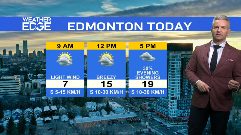
EDMONTON -- Morning sun will give way to some increasing cloud this afternoon in the Edmonton region.
The wind will pick up a bit too.
BUT... temperatures return to average for a couple days with highs near 5 degrees today and Thursday.
A series of low pressure systems will track across the north over the next four or five days.
The first of those is bringing snow to northern Alberta today. 2-5 cm is possible in the Fort McMurray region with 10 cm possible near Fort Chipewyan.
There's a SLIGHT risk of some pockets of precip near Edmonton this afternoon. Those could be wet flurries or rain/snow mix.
No significant precip is expected for the area though.
Two warm days and then a blast of cooler air Saturday. Temperatures rebound Sunday before sliding again Mon/Tue.
Sat/Mon/Tue all look like they'll have highs in the -2 to -5 range.
So enjoy the warmer weather and the melting today. But don't get TOO used to it.
Cooler air is set to return by the weekend.
HERE'S THE FORECAST FOR EDMONTON:
- Today – Sunny this morning. Increasing cloud this afternoon.
- Slight risk of scattered wet flurries or rain/snow mix in the area this afternoon.
- High: 5
- Tonight - Cloudy periods.
- 9pm: -1
- Friday - Cloudy morning, clearing in afternoon.
- Morning Low: -5
- Afternoon High: 4
- Saturday - Mostly cloudy.
- Morning Low: -6
- Afternoon High: -2
- Sunday - Mostly cloudy. 30% chance of late-day flurries.
- Morning Low: -5
- Afternoon High: 2
- Monday - Mostly cloudy. 40% chance of flurries
- Morning Low: -7
- Afternoon High: -4

