Josh Classen's forecast: Heat streak peaks and record highs may fall
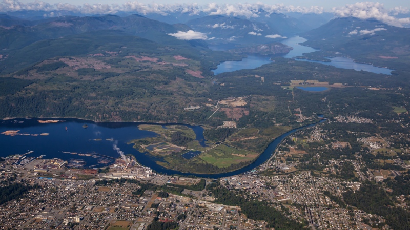
 A picture of downtown Edmonton in the North Saskatchewan River valley on July 8, 2024. (Cam Wiebe / CTV News Edmonton)
Heat warnings and air quality alerts are in effect for large portions of Alberta.
The worst air quality from wildfire smoke is across northern and eastern parts of the province, with Edmonton on the edge and reporting a "moderate risk" this morning.
Modelling from Environment and Climate Change Canada indicates improvements in air quality for areas around Edmonton today and no significant smoke in the area through Tuesday and Wednesday.
Northern and eastern Alberta will continue to deal with smoke through the next few days with areas closer to the fires in northern Alberta dealing with "high to very high risk" readings in the 7 to 10+ range on the Air Quality Health Index.
We have an upper ridge that has moved over much of the province with the northern and eastern edges of that ridge running through northern Alberta and near the Alberta-Saskatchewan border.
The wind rounding the top of that ridge is the main reason those areas will get a lot more smoke than regions beneath the ridge.
That bubble of heat from the surface through the upper levels is also the reason we're dealing with heat warnings across almost all of Alberta.
The mountain parks are the only areas not under a heat warning. Their daytime highs will be hot, but they'll see some relief overnight with cooler morning lows in the forecast.
For Edmonton and area, we'll be very close to the record highs today, Tuesday and Wednesday.
The record highs are:
- July 8: 32.2 C in 1964
- July 9: 35.1 C in 2015
- July 10: 33.0 C in 2001
(Side note: I think today and Wednesday have the best chance at setting new daily record highs.)
I'm conservatively forecasting highs of 31 C today, 32 C on Tuesday, and 33 C on Wednesday. But, there's model output pushing temperatures closer to 34 or 35 C.
These three days will be the hottest days of the heat streak as afternoon temperatures get into the low 30s and morning lows only drop to the 16 to 20 C range.
The AVERAGE high for this week in Edmonton in 23 C , so we'll be about eight to 10 degrees hotter than average.
The ridge looks like it'll break down late Wednesday and that'll likely lead to an outbreak of thunderstorms (possibly severe storms) across much of central and north-central Alberta.
At this time, it's an evening or late-night risk of the Edmonton area on Wednesday.
Temperatures will drop out of the 30s for Thursday-Saturday, but it'll stay hotter than average with afternoon highs in the mid to upper 20s.
Saturday also has a chance of some late-day showers and/or thunderstorms.
Here's the forecast for Edmonton and area:
Today - Sunny.
RECORD: 32.2 -1964
High: 31
Tonight - Clear.
9pm: 28
Tuesday - Sunny.
RECORD: 35.1 -2015
Morning Low: 18
Afternoon High: 32
Wednesday - Mainly sunny. 40% chance of an evening thunderstorm.
RECORD: 33.0 -2001
Morning Low: 20
Afternoon High: 33
Thursday - Mainly sunny.
Morning Low: 18
Afternoon High: 28
Friday - Partly cloudy.
Morning Low: 16
Afternoon High: 27
Saturday - Partly cloudy. 40% chance of late-day showers/thunderstorms.
Morning Low: 16
Afternoon High: 27
CTVNews.ca Top Stories

Ontario Premier Doug Ford threatens to cut off energy to U.S. in response to Trump's tariffs
Ontario Premier Doug Ford has threatened to cut off energy supply to the U.S. in response to the tariffs President-elect Donald Trump plans to impose on all Canadian imports.
Elon Musk calls Justin Trudeau 'insufferable tool' in new social media post
Billionaire Elon Musk is calling Prime Minister Justin Trudeau 'an insufferable tool' in a new social media post on Wednesday. 'Won't be in power for much longer,' Musk also wrote about the prime minister on 'X.'
Sask. hockey coach convicted of historic sex crime back on day parole after 'behavioural concerns'
A former WHL coach found guilty last year of sexually assaulting a teen boy is back on day parole.
The Body Shop Canada to be sold to Serruya Private Equity
The Body Shop Canada is due to be sold to a company led by the co-founder of frozen yogurt chain Yogen Früz.
Trudeau will have to 'kiss the ring' to achieve smoother bilateral relations with Trump: John Bolton
If Prime Minister Justin Trudeau wants to get on U.S. president-elect Donald Trump's good side for the sake of a smooth bilateral relationship, he'll likely have to be openly deferential, says former U.S. National Security Advisor, John Bolton.
'Fire hazard': Health Canada recalls candles over how they burn
Health Canada announced Wednesday a consumer product recall on candles in ceramic containers due to fire hazards, a release from the agency reads.
Luxury real estate brokers charged in federal indictment with sex trafficking in NYC
Two luxury real estate brokers and their brother have been charged with luring, drugging and violently raping dozens of women over more than a decade.
Alberta family doctor suspended for unprofessional conduct
An Alberta family doctor and veterinarian has been suspended for unprofessional conduct.
Police locate labyrinth of tunnels connecting tents to generator in Hamilton encampment
Hamilton police say that they discovered a series of 'man-made holes and tunnels' during a patrol of a downtown encampment earlier this week.


