Josh Classen's forecast: Roller coaster temperatures this week
 An aerial image of downtown Edmonton and the Low Level Bridge taken by drone over Scona Road and Connors Road south of the North Saskatchewan River on March 22, 2024. (Cam Wiebe / CTV News Edmonton)
No sustained warming, but there IS a ripple of warmer air that'll briefly push through this week.
Wednesday's looking to be the warmest day and there's a significant degree of uncertainty with just HOW warm we might get.
I think the 10-11 C range is POSSIBLE, but not as likely as a high in the 5-8 Crange. I've gone with 6 C in my forecast this morning, but that's subject to be tweaked.
We'll see temperatures drop back to the highs near 0 C for Thursday through Saturday.
In the more immediate future, near 0 C for a high this afternoon in Edmonton and then a high of around 3 C Tuesday afternoon.
Morning temperatures should be fairly mild throughout the week. Lows in the city are forecast to be in the -3 to -9 C range.
The longer-term temperature outlook is trending much warmer starting Sunday.
Daytime highs in the 4 C to 9 C range for Sunday through Thursday, with a shot at hitting double-digits on Monday.
PRECIPITATION OUTLOOK:
An area of low pressure will develop in northwestern Alberta late Tuesday.
Most of the modelling keeps the snow ahead of that system and in east-central/northeast Alberta Tuesday night into Wednesday morning.
That said, I'm including a slight risk of some evening flurries into the Edmonton forecast for Tuesday.
Light snow continues in northeastern Alberta through the day Wednesday, but that should all avoid the Edmonton area.
Another system develops in southwestern Alberta early Thursday with a snow zone on the northern edge stretching from the Jasper/Grande Cache area east towards Cold Lake.
I'm putting a chance of showers turning to wet snow into the Edmonton forecast for Wednesday night, and that becomes a chance of wet flurries on Thursday.
At this point, it doesn't look like a significant accumulation for the Edmonton region.
Western Alberta could get a more significant snowfall late Thursday into Friday.
Here's the forecast for Edmonton and area:
Today - Cloudy with a few sunny breaks this afternoon.
High: 0
Tonight - Mostly cloudy.
9pm: -3
Tuesday - Cloudy with a few sunny breaks. 30% chance of evening flurries.
Morning Low: -7
Afternoon High: 3
Wednesday - Partly cloudy. 40% chance of evening showers turning to wet snow.
Morning Low: -3
Afternoon High: 6
Thursday - Cloudy. 40% chance of flurries.
Morning Low: -4
Afternoon High: 0
Friday - Cloudy. 30% chance of flurries.
Morning Low: -6
Afternoon High: -1
Saturday - Mix of sun & cloud.
Morning Low: -8
Afternoon High: 1
CTVNews.ca Top Stories
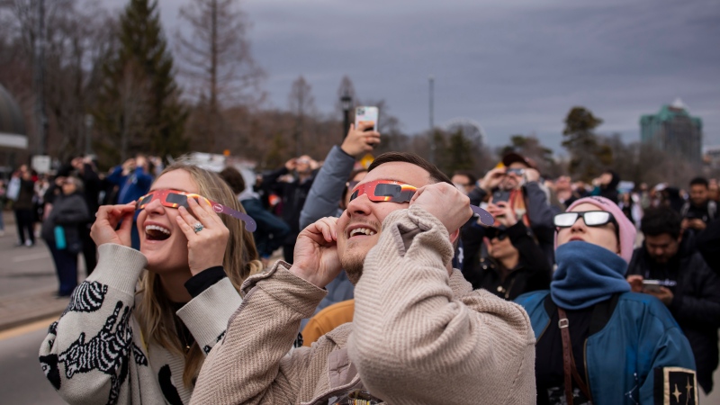
More than 115 cases of eye damage reported in Ontario after solar eclipse
More than 115 people who viewed the solar eclipse in Ontario earlier this month experienced eye damage after the event, according to eye doctors in the province.
Toxic testing standoff: Family leaves house over air quality
A Sherwood Park family says their new house is uninhabitable. The McNaughton's say they were forced to leave the house after living there for only a week because contaminants inside made it difficult to breathe.
Decoy bear used to catch man who illegally killed a grizzly, B.C. conservation officers say
A man has been handed a lengthy hunting ban and fined thousands of dollars for illegally killing a grizzly bear, B.C. conservation officers say.
B.C. seeks ban on public drug use, dialing back decriminalization
The B.C. NDP has asked the federal government to recriminalize public drug use, marking a major shift in the province's approach to addressing the deadly overdose crisis.
OPP responds to apparent video of officer supporting anti-Trudeau government protestors
The Ontario Provincial Police (OPP) says it's investigating an interaction between a uniformed officer and anti-Trudeau government protestors after a video circulated on social media.
An emergency slide falls off a Delta Air Lines plane, forcing pilots to return to JFK in New York
An emergency slide fell off a Delta Air Lines jetliner shortly after takeoff Friday from New York, and pilots who felt a vibration in the plane circled back to land safely at JFK Airport.
Sophie Gregoire Trudeau on navigating post-political life, co-parenting and freedom
Sophie Gregoire Trudeau says there is 'still so much love' between her and Prime Minister Justin Trudeau, as they navigate their post-separation relationship co-parenting their three children.
Last letters of pioneering climber who died on Everest reveal dark side of mountaineering
George Mallory is renowned for being one of the first British mountaineers to attempt to scale the dizzying heights of Mount Everest during the 1920s. Nearly a century later, newly digitized letters shed light on Mallory’s hopes and fears about ascending Everest.
Loud boom in Hamilton caused by propane tank, police say
A loud explosion was heard across Hamilton on Friday after a propane tank was accidentally destroyed and detonated at a local scrap metal yard, police say.


