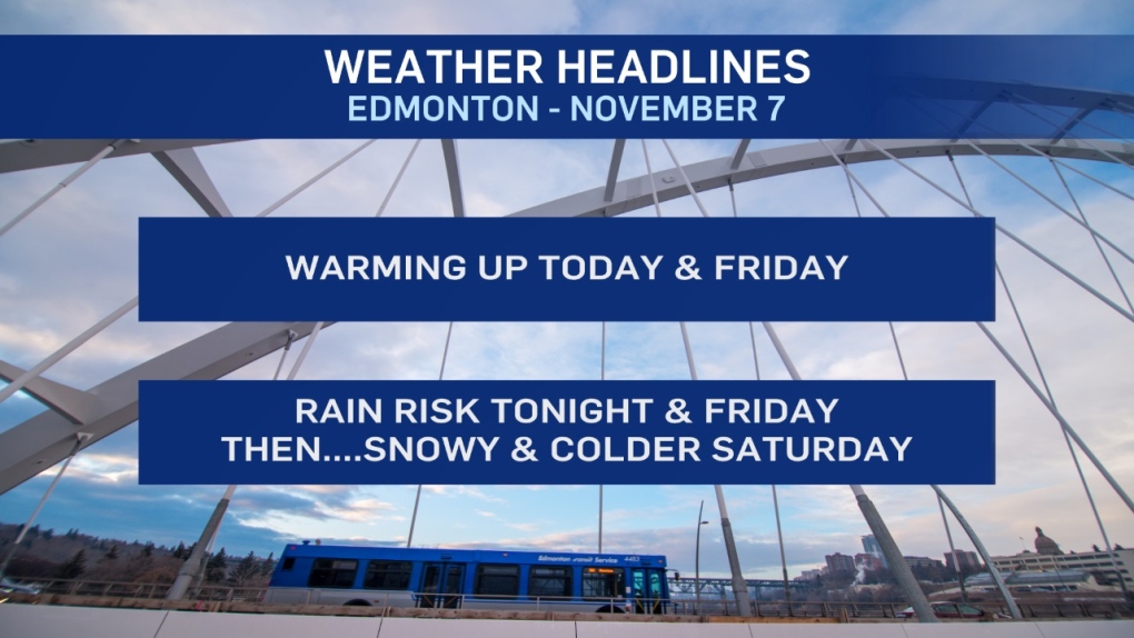
EDMONTON -- Get set for some "swinging" weather over the next few days.
Temperatures will warm up pretty dramatically this afternoon and Friday.
THEN...right back into cold air for the weekend.
And...as so often accompanies those swings...there's precipitation coming in a couple different forms.
Brace for Rain, Freezing Rain and Snow (probably several centimetres of snow).
Showers will start this evening in the Edmonton area. There's a very slight risk of freezing rain, especially in areas just outside the city.
Surface temperatures (for the most part) should stay warm enough to just be wet overnight and early Friday in the city.
Showers (or periods of rain) will continue in Edmonton and areas to the north and NW through the day Friday.
In the Peace Country, the rain turns to snow Friday (possibly with a periods of freezing rain in between) and 10-20 cm is possible by Saturday.
Heavy snow will develop in the foothills and mountains parks Friday night and Saturday. Southern Alberta gets some heavier snow on Sunday.
In Edmonton, the rain flips to snow Friday night. Snowfall totals are still a bit iffy. BUT...1-5 cm is possible by Saturday morning and another 1-5 cm could fall Saturday.
So, somewhere between 2 and 10 cm seems likely by the end of Saturday.
Here's the forecast for Edmonton:
- Today – Mostly cloudy.
- 5pm: 2
- Tonight - Mostly cloudy. Showers (with a freezing rain risk) overnight.
- 9pm: -1
- Friday - Mostly cloudy. 80% chance of showers or periods of rain during the day.
- Morning: 1
- Afternoon High: 6
- Rain turning to snow in the evening. Periods of snow overnight.
- 2-5 cm possibly by morning.
- Saturday - Cloudy. 70% chance of snow. 2-5 cm possible.
- Temperature falling through the day.
- Morning: -7
- Afternoon: -11
- Sunday - Partly cloudy.
- Morning Low: -17
- Afternoon High: -11
- Monday - Partly cloudy.
- Morning Low: -15
- Afternoon High: -7
- Tuesday - Mix of sun & cloud.
- Morning Low: -11
- Afternoon High: -3
