Josh Classen's forecast: Nearing the end of the heatwave
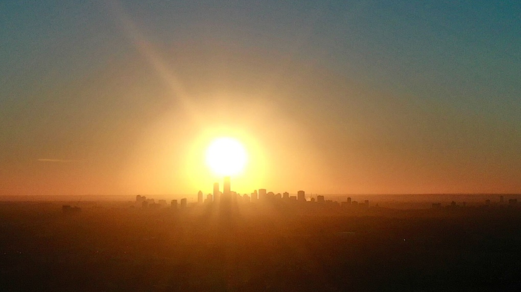
 Edmonton skyline.
Two more days of 30 C heat and then some cooler air moves in. Temperatures looks like they'll be near 20 C for daytime highs by Friday/Saturday.
That's where our morning LOWs have been the past several days.
We'll talk about the smoke in a moment, but first let's deal with the heat for today and Tuesday.
Temperatures hit a record-setting 33.8 C on Sunday. That broke the old record of 32.8 C from 1945.
It's unlikely that we'll set any record highs today and/or Tuesday.
A lot will depend on how thick the smoke is, but even if it completely cleared out...I'm skeptical we could beat today's record of 34.5 C (set in 2006).
Tuesday's record high is 33.4 C (also from 2006). That one looks safe as well.
I think we'll get to the 31-34 C range today and the 29-32 C range Tuesday.
Today will be Edmonton's 7th consecutive day above 30 C. That ties the all-time record from 2021. (There are only two other years with five or more.)
There's about a 50/50 chance that we break that record tomorrow. Again, a lot will depend on the smoke situation.
And with that, let's get into the smoke forecast.
To be clear...smoke forecasting is MUCH more difficult and less reliable than cloud/precipitation/temperature forecasts.
The models DID indicate smoke would move into the Edmonton area for the weekend, but was off on the thickness (particularly for Saturday).
With that said, expect SOME variability in air quality through the coming days. However, it doesn't look like we'll get any better than a moderate risk and there may be times we're back into an extreme risk situation like Saturday.
Also, with smoke now present across much of B.C., Alberta and Saskathcewan...it's not even so much a matter of determining if the wind is coming at us from areas with fires. We're now trying to determine where exactly the thickest smoke is and whether or not the wind is coming from those areas AND/OR regions with fires.
Bottom line: the hazy conditions will persist for the foreseeable future with some days being a bit better and some days having thick smoke.
And...there's probably not going to be a lot of advance warning on when those changes will occur.
Thunderstorms are already developing in northwestern Alberta this morning and we'll see more of that through the day in that region.
We're not anticipating any thunderstorms in the Edmonton area today or Tuesday.
Wednesday would be our next-best chance to get some precipitation. There's a chance of showers in the morning and a risk of thunderstorms later in the day.
Thursday also has a very high probability of showers or periods of rain.
Two last notes: I'll write up a separate article detailing all the records from the past few days, so look for that on our website later today.
Also, I'm on an extended stretch of holidays starting Tuesday. This will be my last WxBlog until next week.
Here's the forecast for Edmonton and area:
Today - Sunny & hazy. Smoke increasing through the day.
Wind SE 20 gusting to 40 this afternoon.
RECORD: 34.5 - 2006
High: 33
Tonight - A few clouds & hazy.
9pm: 29
Tuesday - Mainly sunny. (smoke uncertain)
RECORD: 33.4 - 2006
Morning Low: 23
Afternoon High: 31
Wednesday - Mix of sun & cloud. 60% chance of showers and/or thunderstorms.
Morning Low: 19
Afternoon High: 26
Thursday - Mostly cloudy. 60% chance of showers.
Morning Low: 15
Afternoon High: 20
Friday - Mix of sun & cloud.
Morning Low: 12
Afternoon High: 21
Saturday - Partly cloudy.
Morning Low: 12
Afternoon High: 25
CTVNews.ca Top Stories

Woman who was denied a liver transplant, after review highlighted alcohol use, has died
Questions are being raised about the case of a 36-year-old Ontario woman who died of liver failure after she was rejected for a life-saving liver transplant after a medical review highlighted her prior alcohol use.
Ontario's first domestic case of human rabies since 1967 confirmed in Brant County
A Brant County resident is in hospital after they tested positive for rabies.
Teen girl charged with attempted murder after student set on fire at Saskatoon high school
A 14-year-old girl faces an attempted murder charge after a 15-year-old girl was doused in a flammable substance and set on fire at a Saskatoon high school Thursday.
Montreal man given $664 fine for tying dog to parking meter while grabbing a croissant
A Montreal man who tied his dog to a parking meter while he entered a bakery is now facing a hefty fine for breaking a law he had no idea existed.
Molson Coors ends diversity, equity and inclusion policies, moves to 'broader view'
Brewing company Molson Coors says it is dropping its diversity, equity and inclusion policies and taking a 'broader view' in which all employees know they are welcome.
Selena Gomez is a billionaire
Selena Gomez can now add becoming a billionaire to her long list of achievements.
She met a man on a rooftop bar on her first night in Paris. Her life changed forever
To Erin Tridle, it felt as though the universe paved the way for her to meet the love of her life years before their actual meeting.
Teen charged in Georgia school shooting and his father to stay in custody after hearings
The 14-year-old suspect in a shooting at a Georgia high school that killed four people and his father will both stay in custody following back-to-back court hearings Friday morning where their lawyers declined to seek bail.
A Canadian airline is changing its check-in deadline for all flights. Here's why
Travellers will have to check in 15 minutes earlier than usual according to Air Canada's new cutoff time for all flights.


