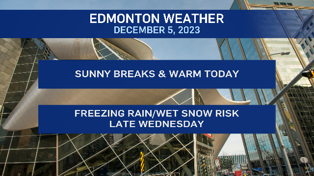
Josh Classen's forecast: Mild streak continues, with a precipitation risk late Wednesday

A blast of warm air (and a short-lived upper ridge) will keep temperatures well above 0 C in the Edmonton area today.
BUT...we're getting snow freezing rain across northern Alberta this morning.
Freezing rain warnings are in effect for northern Alberta, including Peace River and High Level, Wabasca, Fort McMurray and Fort Chipewyan regions.
That precipitation should move in north Saskatchewan later this morning.
There's also a chance of some showers in areas just north of Edmonton and toward the Cold Lake area early this afternoon.
Just a SLIGHT risk of a couple sprinkles around the Edmonton region early this afternoon.
Heavy snow at higher elevations in the mountains and a rain/snow mix at lower levels (including Jasper).
We're already above 0 C in Edmonton EARLY Tuesday morning and temperatures should hit a high near 6 C in Edmonton this afternoon, maybe a degree or two warmer.
Realistically, it could be anywhere between 5 C and 10 C depending on how much wind we get to help mix some of the warmer air aloft down to the surface.
Wednesday starts out a bit cooler than today (morning low near -6 C). We'll get a bit of sun in the morning and then increasing clouds through the afternoon with a high near 3 C.
An area of low pressure set to sweep across southern Alberta late Wednesday will produce some rain changing over to snow for areas from at least Red Deer south.
There's still some uncertainty with how far north that precipitation will stretch and where exactly the heaviest band of wet snow will develop.
It looks UNLIKELY that we'll see that heaviest band of snow over Edmonton. But, there IS a chance of some freezing rain Wednesday evening, potentially turning over to some wet snow or mixed precipitation overnight and through Thursday morning.
IF that wet snow avoids the city and stays to the south, our next chance of flurries doesn't come until Sunday (and that doesn't look like a significant snowfall).
Temperatures trend cooler through the end of the week. Near 0 C for a daytime high Thursday and then mornings in the -10 C to -15 C range for Friday and Saturday.
Afternoon highs in the -1 C to -4 C range for Friday-Sunday.
Here's the forecast for Edmonton and area:
Today - Mix of sun & cloud.
High: 6
Tonight - Partly cloudy.
9pm: -1
Wednesday - Partly cloudy morning. Mostly cloudy afternoon.
Morning Low: -6
Afternoon High: 3
30% chance of freezing rain or rain/snow mix in the evening/overnight.
Thursday - 30% chance of flurries in the morning. Sunny breaks in the afternoon.
Morning Low: -4
Afternoon High: 1
Friday - Partly cloudy.
Morning Low: -12
Afternoon High: -3
Saturday - Partly cloudy.
Morning Low: -12
Afternoon High: -3
Sunday - Mostly cloudy. 30% chance of flurries.
Morning Low: -9
Afternoon High: -2
CTVNews.ca Top Stories

LIVE UPDATES Critical infrastructure 'successfully protected': Jasper park officials
Jasper National Park officials in an update said all critical infrastructure in the townsite has been 'successfully protected, including the hospital, emergency services building, both elementary and junior/senior schools, activity centre and wastewater treatment plant.'
Canadian Olympic Committee removes women's soccer team's head coach over drone scandal
The Canadian Olympic Committee has removed women's national soccer team head coach Bev Priestman over a drone scandal, according to a press release from the organization.
Yukon woman narrowly escapes bear attack, credits hair clip
A woman in Yukon believes her hair clip helped save her during a bear attack.
Prince William's 2023 salary revealed in new report
Newly released financial reports show that William, the Prince of Wales, drew a salary of $42.1 million last fiscal year, his first since inheriting the vast and lucrative Duchy of Cornwall.
'I was just shocked': Jasper lodge owner on seeing property destroyed by wildfire
On Wednesday night, the owner of Maligne Lodge in Jasper, Alta., was shocked to receive a photo of her business engulfed in flames.
Mary-Ellen Turpel-Lafond likely has Indigenous DNA: report
The Law Society of British Columbia says a DNA test shows a former judge and Order of Canada recipient accused of falsely claiming to be Cree "most likely" has Indigenous heritage.
U.S. authorities have arrested 'El Mayo' Zambada, a historic leader of Mexico's Sinaloa cartel
Ismael 'El Mayo' Zambada, a historic leader of Mexico's Sinaloa cartel, and Joaquin Guzman Lopez, a son of another infamous cartel leader, were arrested by U.S. authorities in Texas on Thursday, the U.S. Justice Department said.
Harris pushes Netanyahu to ease suffering in Gaza: 'I will not be silent'
U.S. Vice President Kamala Harris pressured Israeli Prime Minister Benjamin Netanyahu on Thursday to help reach a Gaza ceasefire deal that would ease the suffering of Palestinian civilians, striking a tougher tone than President Joe Biden.
'She led it the whole way': 18-year-old B.C. woman leads hikers to safety in Jasper National Park
As fire threatened people in Jasper National Park, Colleen Knull sprung into action.


