Timeline of Monday's severe storms across central Alberta
'Very unstable' atmospheric conditions across central Alberta prompted a series of weather alerts Monday afternoon and into the evening.
According to the Prairie and Arctic Storm Prediction Centre, severe storms were forecasted to develop across the foothills to central regions of the province, with the potential for heavy rain, large hail, and wind gusts.
Tornado warnings are issued when thunderstorms capable of producing tornadoes and severe weather are happening or are likely to occur.
Watches are issued by Environment Canada when atmospheric conditions are favourable for the development of thunderstorms that could produce tornadoes.
Here is a timeline of the major alerts and warnings:
ALERT AT 7:28 P.M.
At 7:28 p.m., the previously issued tornado warnings and alerts for Kneehill County and Red Deer County were dropped after the storm was "no longer expected to produce a tornado."
The storm was still capable of producing damaging winds, locally intense rainfall, and large hail — with some communities seeing up to baseball sized hail.
As of 9:13 p.m., most of central Alberta remained under a tornado watch.
ALERT AT 7:05 P.M.
At that point, the rotating severe thunderstorm possibly producing a tornado was located 10 kilometres north of Highland Rand, moving southeast at 30 kilometres per hour. The communities of Highland Ranch and Huxley were in its path.
Officials warned residents and visitors in several counties of severe thunderstorms that had potential to produce tornadoes in central Alberta Monday afternoon.
"Seek shelter immediately in a basement or reinforced structure," the alert read. "Get low and put as many walls between yourself and the storm as possible.
"Stay away from windows, doors and outside walls. If you are on the highway and cannot avoid the tornado, seek shelter in a ditch or ravine."
"This is a dangerous and potentially life-threatening situation," the tornado warning read. "Take cover immediately, if threatening weather approaches.
"If you hear a roaring sound or see a funnel cloud, swirling debris near the ground, flying debris, or any threatening weather approaching, take shelter immediately.
ALERT AT 6:41 P.M.
The storm had Knee Hill Valley and Milnerton in its path, officials warned. It was moving southeast at 40 kilometres per hour.
Pine Lake was placed under a tornado warning at 6:33 p.m., alongside the Kneehill County communities of Torrington, Wimborne, Trochu, and Huxley. Elnora, Lousana, and Delbure were added around 7:15 p.m.
ALERT AT 6:12 P.M.
At that point, the storm was moving toward and then through the communities of Niobe and Penhold. Thirty minutes later the tornado warning for Penhold, Innisfail, and Bowden was ended.
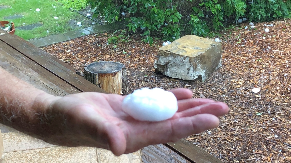
 Egg sized hail fell near Penhold, Alta., around 6:20 p.m. on Monday, Aug. 1, 2022 (Supplied).
ALERT AT 6:04 P.M.
The tornado warning for Sylvan Lake and Stephansson House was dropped. Tornado watches for those and surrounding communities remained in effect. The storm had moved through Markerville and continued east.
ALERT AT 5:28 P.M.
Another severe storm was located 20 kilometres northwest of Markerville, moving east at 40 kilometres per hour. Officials indicated it could be producing a tornado.
At 5:50 p.m., a tornado warning was issued for Red Deer County, specifically near Penhold, Innisfail, and Bowden.
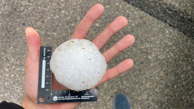
 Baseball size hail northwest of Markerville, Alta. (Source: Prairie Storm Chasers/Braydon Morisseau)
ALERT AT 4:33 P.M.
A storm capable of producing a tornado was warned about in Brazeau and Yellowhead counties, located at 4:26 p.m., 20 kilometres north of the Brazeau Dam. It was moving east at 40 kilometres per hour.
The alert was shortlived and ended 13 minutes later as tornadoes were "no longer expected" with that thunderstorm.
ALERT AT 3:48 P.M.
According to a tornado warning, a rotating thunderstorm possibly producing a tornado was near Rocky Mountain House, moving east at 50 kilometres per hour, with the storm edging closer to that community and Codner.
That alert was downgraded by 4:03 p.m. to a tornado watch.
ALERT AT 3:29 P.M.
The storm was moving east at 50 kilometres per hour, with the communities of Ferrier and Rocky Mountain House in its path, alerts said.
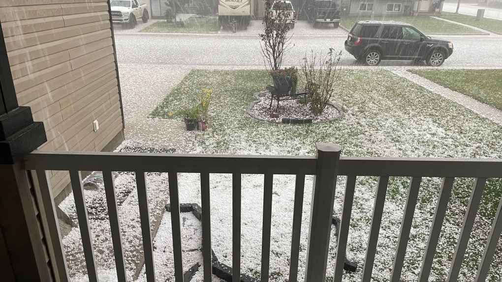
 Massive amounts of hail fell in Rocky Mountain House as a severe storm moved through Alberta (Supplied).
ALERT AT 2:57 P.M.
An Alberta Emergency Alert was issued, indicating a rotating thunderstorm was possibly producing a tornado near Horburg, moving southeast at 35 kilometres per hour toward that community. That alert was dropped by 3:30 p.m.
ALERT AT 2:17 P.M.
As of 2:13 p.m., a storm was located around 10 kilometres west of Saunders, moving southeast at 40 kilometres per hour.
Several minutes later, the alert was updated to include that the communities of Saunders and Ancona were in the storm's path. That alert ended at 2:41 p.m. as the storm moved past the communities.
CTVNews.ca Top Stories

Second Cup closes Montreal franchise over hateful incident
Second Cup Café has closed one of its franchise locations in Montreal following allegations of hateful remarks and gestures made by the franchisee in a video that was widely circulated online during a pro-Palestinian protest on Thursday.
‘It’s pretty emotional:’ N.B. family escape fire, plan to rebuild home
A family in Riverview, N.B., is making plans for Christmas and the future after escaping a fire in their home on November, 14.
Cargo ship runs aground in St. Lawrence River near Morrisburg, Ont.
A large cargo ship remains stuck in the St. Lawrence River after running aground on Saturday afternoon.
Scurvy resurgence highlights issues of food insecurity in Canada's rural and remote areas
A disease often thought to only affect 18th century sailors is reemerging in Canada.
B.C. man awarded $800K in damages after being injured by defective bear banger
A B.C. man has been awarded nearly $800,000 in damages as compensation for injuries he sustained from a defective bear banger, according to a recent court decision.
A man called 911 for help during a home invasion. Las Vegas police fatally shot him
A Las Vegas man called for police help during a home invasion before an officer fatally shot him, according to authorities and 911 calls.
Cat caught in hunting snare rescued by BC SPCA
Donations are ramping up for a BC SPCA cat with a mangled paw after being caught in a hunting snare, one of a rising number of pets to fall prey to the hunting device.
These royal residences are opening their doors this Christmas
Not so long ago, if you wanted to spend Christmas with the royal family, the only way to get close was to press your nose up to the TV screen during the monarch’s Christmas speech.
'Still working full time on it:' One year later police continue to search for gunman in Caledon double murder linked to ex-Olympian
One year after a couple was shot and killed in their Caledon home in what investigators have described as a case of mistaken identity, Ontario Provincial Police say they are still trying to figure out who pulled the trigger.


