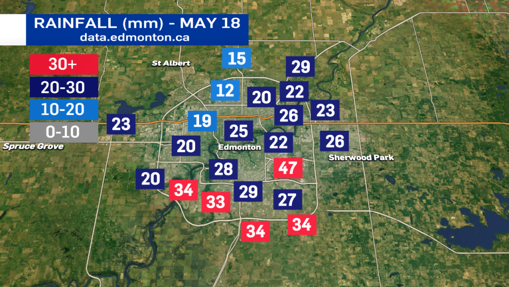
EDMONTON -- 15 to 40 mm of rain has fallen in the Edmonton area (up to 6 p.m. Tuesday) and we're not done with the precipitation yet.
Rain will continue into this evening with the heaviest, steadiest rain continuing to affect southern parts of the city and areas to the south and southwest of Edmonton.
By mid-to-late evening, that rain will flip over to snow and we'll likely see the snow continue into the morning hours of Wednesday before tapering off by midday.
Snow accumulation is still fairly uncertain. But, there could be 1 to 3 cm of accumulation (especially on grassy areas) in and around the Edmonton region.
Temperatures will also be down around the freezing mark Wednesday morning, which could make for some slick roads and sidewalks.
Edmonton probably won't get above 5 or 6 degrees Wednesday afternoon and both Thursday and Friday morning have a risk of frost with temperatures dipping into the -1 to -5 range.
Warmer air will return for the weekend with highs back into the mid to upper teens Fri/Sat and then around 20 Sun/Mon.
