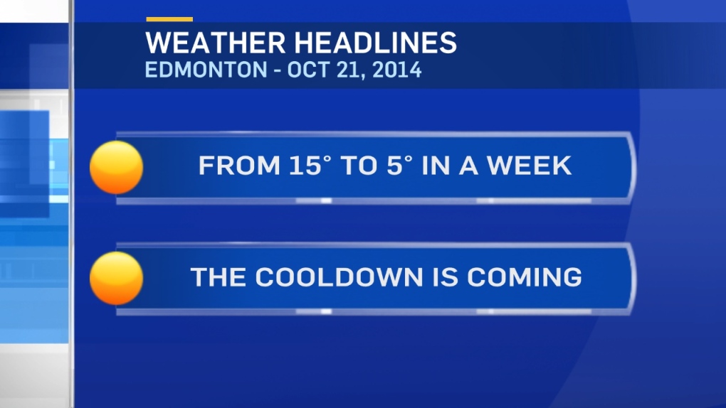
The outlook is for a 10 degree drop from this week to next.
Enjoy the warm weather for the next few days. We're in the 5 or 6 degree range next week.
We get a much less dramatic cooldown today.
Yesterday, we had record-setting heat in many areas of central & southern Alberta
No record for Edmonton City Centre, yesterday's high of 22.3 was short of the 25.6 degree record high.
But, Edmonton Int'l Airport DID break a record. Yesterday's high of 22.0 topped the previous record of 19.4 set in 1999.
Today - we slip into the mid teens in the Capital Region.
Similar temperatures should hold for Thursday & Friday.
Then...we dive into the 7-11 degree range for Saturday.
By Sunday/Monday, we're looking at daytime highs of 5 or 6 degrees.
(that's cooler than this morning's LOW)
By next week...an Upper Trough replaces the warm Upper Ridge that we've had in place.
That cooler air aloft may even be cold enough for snow in parts of Northern Alberta this weekend.
The 30-year average high drops from 10 to 5 between now & next Tuesday.
So, it appears we're "right on schedule" with this cooling trend.
Here's the Edmonton forecast:
Today - Mix of sun & cloud.
High: 16
Tonight - A few clouds.
Low: 6
Wednesday - Increasing afternoon cloud.
High: 15
Thursday - Mostly cloudy. 40% chance of a late-day shower.
Morning Low: 6
Afternoon High: 15
Friday - Mix of sun & cloud.
Morning Low: 4
Afternoon High: 12
Saturday - Mostly cloudy. 30% chance of showers.
Morning Low: 2
Afternoon High: 10
Sunday - Mostly cloudy.
Morning Low: 2
Afternoon High: 6
Advertisement
WARM...FOR NOW - October 21, 2014
CTV Edmonton
Published Tuesday, October 21, 2014 7:18AM MDT
Published Tuesday, October 21, 2014 7:18AM MDT
