Another day of heat & (again) a risk of storms.
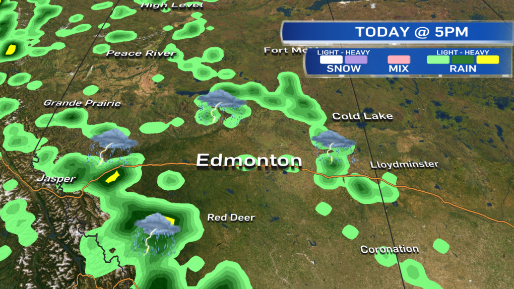
The risk IN the city is a bit lower than yesterday (and much lower than Thursday).
But...we can't say there's NO CHANCE of a storm popping up over or near Edmonton later this afternoon/evening.
Isolated thunderstorms POUNDED parts of the Capital Region Tuesday.
Most of the city had nothing more than a view of those storms.
But, areas that DID get hit (particularly the E end of the city) had small hail & 20-60mm of rain.
Again today, MOST of the Capital Region (and really, MOST of Central & North-Central Alberta) will not be hit by storms.
However...where the storms DO develop, heavy downpours & hail will be the main risk.
These storms won't move much. They'll pop up...POUR...and then die out.
The most likely area for development will be E & N of Edmonton.
We'll also see some storms in the foothills later today & this evening.
Thursday looks like a VERY active day for storms, potentially severe storms again.
We should get some sun on Canada Day. BUT...parts of western Alberta will run the risk of a shower or thunderstorm.
The Capital Region MIGHT see a shower or storm move through Friday night.
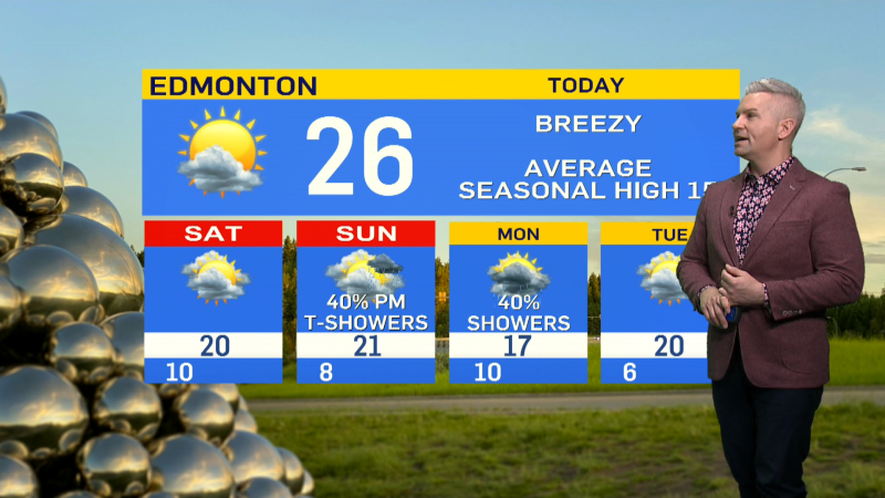
Here's the Edmonton forecast:
Today - Sunny with afternoon clouds. 30% chance of thunderstorms in the area late this afternoon.
High: 27 (feeling 30 with humidity)
Tonight - 40% chance of an early-evening thunderstorm. Clearing overnight.
Evening: 23
Thursday - Increasing cloud. 70% chance of an afternoon and/or evening shower or thunderstorm.
Morning Low: 14
Afternoon High: 26
Friday - Partly cloudy.
Morning Low: 15
Afternoon High: 26
30% chance of a shower or thunderstorm Friday night.
Saturday - Partly cloudy.
Morning Low: 15
Afternoon High: 24
Sunday - Partly cloudy. 30% chance of a late-day shower.
Morning Low: 13
Afternoon High: 25
Monday - Mix of sun & cloud. 40% chance of a late-day shower or thunderstorm.
Morning Low: 13
Afternoon High: 23
Advertisement
HEAT CONTINUES - June 29, 2016
CTV Edmonton
Published Wednesday, June 29, 2016 8:44AM MDT
Published Wednesday, June 29, 2016 8:44AM MDT
