Josh Classen's forecast: Snowy and cold today; deep freeze begins Wednesday

Edmonton and area will likely get as much snow by the end of today as we had through all of the winter so far.
Most of the "heavier" snow will hit the area this morning, and then it'll taper off to lighter snow through the afternoon and evening.
Looks like 3-8 cm by this evening and possibly another centimetre or two tonight.
Flurries/light snow will add another dusting Wednesday (possibly a centimetre or two through the day).
Bottom line: It'll look a lot more wintry by the end of the day, but it won't be a back-breaking amount of snow.
After Wednesday, no snow expected until maybe Tuesday or Wednesday of next week in Edmonton and area.
Elsewhere: a broad area of 5-10 cm is expected across most of central and north-central Alberta today and tonight.
The heaviest snow will be in the Hinton/Edson/Grande Cache/Grande Prairie areas. 10-15 cm is anticipated by the end of today and snowfall warnings are in place for that region.
Temperatures will be on the cold side today, but this will be nothing compared to the coming days.
The "deep freeze" doesn't REALLY start until Wednesday and bottoms out Thursday/Friday/Saturday.
Today, we'll have temperatures in the -12 C to -13 C range through the morning and wind chill around -20.
By late this afternoon, we'll cool to the mid minus teens and wind chill will be in the mid minus 20s.
Actual wind speeds should be 15-20 km/h through the day.
Temperatures in the -20s and wind chill around -30 all day Wednesday.
THEN...temperatures in the -25 to -30 C range Thursday, wind chill in the -35 to -40 range ALL DAY.
Wind should back off Friday/Saturday, although temperatures are expected to be in the mid minus 30s in the mornings and afternoon highs will be around -30 C.
So...at those temperatures, even a light 5-10 km/h wind could produce a significant wind chill.
There's an extreme cold warning in effect for High Level and Fort Chipewyan regions today.
That warning will probably get extended further south in the coming days and don't be surprised if that includes the Edmonton area later this week.
Here's the forecast for Edmonton and area:
Today - Cloudy with periods of snow, heaviest in the morning. 3-8 cm.
Wind: E 20 km/h this morning, NE 15 km/h this afternoon.
9am: -13 (wind chill near -22)
Noon: -12 (wind chill near -19)
5pm: -16 (wind chill near -24)
Tonight - Cloudy with light snow. 1-2 cm.
Wind: N 10 km/h
9pm: -18 (wind chill near -25)
Wednesday - Cloudy. 70% chance of light snow. 1-2 cm possible.
Wind: N 10-15 km/h
Temperature falling through the day.
Morning: -22 (wind chill near -31)
Afternoon: -24 (wind chill near -33)
Thursday - Cloudy with a few sunny breaks.
Wind: N 10-20 km/h
Morning Low: -28 (wind chill near -38)
Afternoon High: -27 (wind chill near -37)
Friday - Partly cloudy. Light wind.
Morning Low: -34
Afternoon High: -29
Saturday - Partly cloudy. Light wind.
Morning Low: -36
Afternoon High: -30
Sunday - Mainly sunny. Breezy.
Morning Low: -32
Afternoon High: -25
CTVNews.ca Top Stories
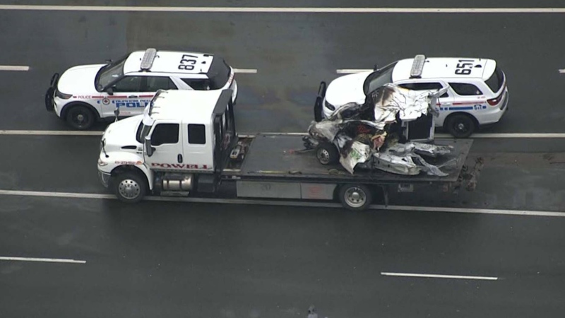
BREAKING Parents of infant who died in wrong-way crash on Ontario's Hwy. 401 were in same vehicle
Ontario’s Special Investigations Unit has released new details about a wrong-way collision in Whitby on Monday night that claimed the lives of four people.
Three Quebec men from same family father hundreds of children
Three men in Quebec from the same family have fathered more than 600 children.
'What have we done?' Lawyer describes shock at possible role in Trump's 2016 victory
A lawyer who negotiated a pair of hush money deals at the centre of Donald Trump's criminal trial recalled Thursday his "gallows humor" reaction to Trump's 2016 election victory and the realization that his hidden-hand efforts might have contributed to the win.
Conservative MP says Chinese hacking attack targeted his personal email
A Conservative MP is challenging claims by House of Commons administration that a China-backed hacking attempt did not impact any members of Parliament, because the attack was on his personal email.
B.C. mayor stripped of budget, barred from committees over Indigenous residential schools book
A British Columbia mayor has been censured by city council – stripping him of his travel and lobbying budgets and removing him from city committees – for allegedly distributing a book that questions the history of Indigenous residential schools in Canada.
Loblaw leaders call criticism 'misguided,' say they aren't to blame for high food prices
Loblaw chairman Galen Weston and the company's new CEO are pushing back against critics who blame the grocery giant for soaring food prices, as a month-long boycott of the retailer gets underway.
Orangutan observed treating wound using medicinal plant in world first
Scientists working in Indonesia have observed an orangutan intentionally treating a wound on their face with a medicinal plant, the first time this behavior has been documented.
'Giant-killer' Kazushi Kimura to race in Kentucky Derby this weekend: 'I'm representing Canada and Japan'
Six years ago, at age 18, Kazushi Kimura left his home and family behind in Hokkaido, Japan to chase a dream. This weekend, he'll ride in the Kentucky Derby.
President Joe Biden calls Japan and India 'xenophobic' nations that do not welcome immigrants
President Joe Biden has called Japan and India “xenophobic” countries that do not welcome immigrants, lumping the two with adversaries China and Russia as he tried to explain their economic circumstances and contrasted the four with the U.S. on immigration.


