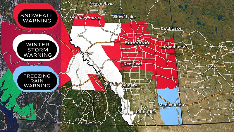
Environment Canada has issued weather warnings for parts of central and northern Alberta, and for areas in the Rocky Mountains.
Starting late Wednesday morning, snowfall warnings were issued for a number of areas, including the Capital Region.
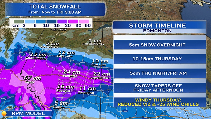
“The snow will start this evening and continue all day [Thursday],” CTV Edmonton Meteorologist Josh Classen said. “Edmonton’s heaviest snow will likely be early in the day Thursday.
“By Thursday night and Friday, it should be tapering off.”
High winds will be a factor in Thursday’s weather, Classen said.
“Wind will be a factor all day. Blowing snow will significantly reduce visibility on highways around the region,” Classen said. “We’ll also be dealing with wind chill making it feel in the -25 degree [Celsius] range Thursday afternoon.”
The snowfall warnings are in effect for the following regions:
- Edmonton - St. Albert – Sherwood Park
- Leduc – Camrose – Wetaskiwin - Tofield
- Spruce Grove – Morinville – Mayerthorpe – Evansburg
- Westlock – Barrhead - Athabasca
- Drayton Valley – Devon – Rimbey – Pigeon Lake
- Fort Saskatchewan – Vegreville – Redwater – Smoky Lake
- Grande Prairie – Beaverlodge – Valleyview
- Red Deer – Ponoka – Innisfail – Stettler
- Rocky Mountain House – Caroline
Officials said a total of 20 to 30 centimetres of snow is expected to fall starting Wednesday night, and continuing through Friday.
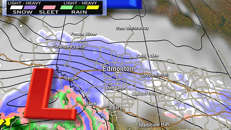
In addition, snow over the mountain parks is expected to increase Wednesday afternoon, spreading north into the Grande Prairie area, and continuing east towards Edmonton and the surrounding areas overnight.
The snow is expected to continue to fall, before the weather system moves on to Saskatchewan.
In addition, winter storm warnings have been issued for:
- Banff National park
- Jasper National Park
- Hinton – Grande Cache
- Whitecourt – Edson – Fox Creek – Swan Hills
- Nordegg – Forestry Trunk Road Highway 734
- Kananaskis - Canmore
- Crowsnest Pass - Pincher Creek - Waterton Lakes National Park
Snowfall is expected to reach between 30 to 50 centimetres, and some areas could see up to 75 centimetres of snow – the areas that officials believe will be the hardest hit includes Grande Cache and the Icefields Parkway.
Jasper and Banff townsites are also expected to see significant snowfall, but with less accumulating snow.
The winter storm warning is issued when 25 centimetres of snow, or more are expected to fall in 24 hours or less – as a result, travel in these areas is not recommended.
After the snow falls, an Arctic air mass will drop daytime highs below normal for the weekend.
“Once the snow is done, settle in for a cold weekend,” Classen said. “The coldest temperature so far this season was -21 [degrees Celsius] on the morning of November 14. We’ll have daytime highs in that range this weekend.”
City of Edmonton crews prepared for snowfall
Meanwhile, as Edmontonians prepare themselves to deal with the blanket of snow, crews with the City of Edmonton are prepared to make roadways passable.
“I think everybody is kind of anxious to get that first storm,” Bob Dunford, Director of Roadway Maintenance, said Wednesday.
Earlier Wednesday, officials said city staff prepared snow equipment for the anticipated snowfall, and ironed out logistics ahead of time.
If the system proves to be too much for City crews, a whole fleet of contractors are on standby to help out.
“The focus is on let’s keep everybody moving rather than just trying to clear up the first part of a storm is just keep everybody moving, so we’ll just ramp up with more people,” Dunford said.
The City admitted crews have had a ‘gentle’ introduction to winter this season, and the expected snowfall will be the biggest test yet.
With files from Danelle Boivin
